Last modified 19 July 2006 00:05 Eastern Time
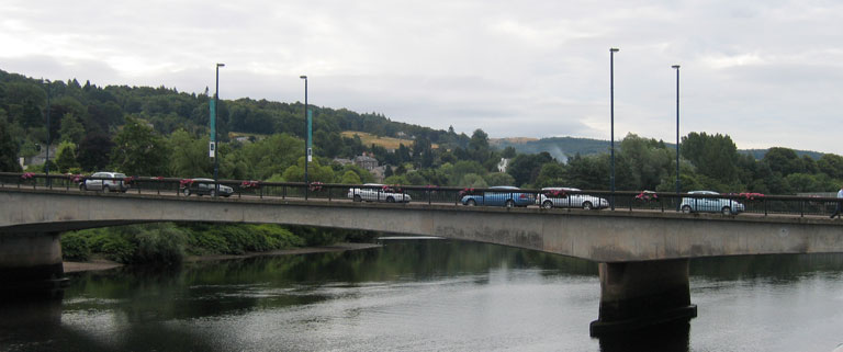
After walking out of direct sight of everyone else, I got much better pictures of the bridge. I also got a number of images of various plaques, which y'all can now read in straight text instead of having to transcribe them, as I've got to do.
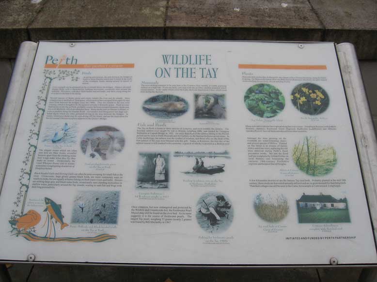
For instance, this bit titled "Wildlife on the Tay":

Yes, I know you can't read the image, so here's the text:
BirdsIn spring and summer, the area between the bridges is home to Sand Martins which nest in holes in the walls of the riverbank, busily darting around in search of insects. Gray wagtails can be glimpsed on the riverbank below the bridges. Dippers are small dumpy birds, with a characteristic bobbing movement, commonly seen around the ladeside. Moorhens, with their black bodies and red beaks, rear their young along the river and on the lade in the spring. Several species of ducks, geese and swans inhabit the river and its islands. Most conspicuous is the flock of feral geese, which seem to have escaped from captivity and have lived between the bridges since the 1990s. They are related to the true wild Greylag, which is thought to be the ancestor of today's domestic geese. There are also feral ducks on the Tay at Perth, probably crosses between escaped domestic ducks and true wild Mallards, which are abundant here. Many ducks nest on Stanner's Island, or even in gardens along the Dundee Road. Goosanders and Mergansers are large saw-billed ducks which are often glimpsed diving in the area between the bridges. In winter, Goldeneye ducks may be seen diving off Tay Street, and are the inspiration for David Annand's bronze sculpture adjacent to the Queen's Bridge. The elegant swans which are often seen here are Mute Swans, so-called because apart from the creaking noise their wings make when they fly, they make no sound. Occasionally, the vocal Whooper Swans visit in winter, sometimes congregating downriver at Sleepless Inches. Black-headed Gulls and Herring Gulls can often be seen swooping for small fish in the river. Cormorants, large glossy greeny-black birds, are more commonly seen on seashore rocks, but are equally at home fishing on fresh water rivers and lochs. Herons are striking large grey and black water birds, occasionally seen standing motionless in shallow water, particularly around the Tay island, waiting to stab fish and frogs with their long pointed bills. MammalsThe most striking mammal to be seen here is the Common Seal, usually in winter, pursuing salmon on a high tide. If you are lucky, you may even see an Otter, another mammal which enjoys salmon. In the vaults which cover the Lade, there are Daubenton's Bats, which roost there during the daytime. Fish and PearlsThe Tay at Perth is home to three species of Lamprey, and most notably the Salmon. The heaviest salmon ever caught by rod in Britain, weighing 64lb, was landed by Georgina Ballantine at Caputh Bridge in 1922. An early depiction of the salmon dating to the Pictish period can be seen in Perth Museum and Art Gallery on the famous Inchyra carved stone. In Celtic mythology, the salmon was the symbol of wisdom, and those who ate the flesh of the first salmon of the year were blessed with this figt. Today, at Kenmore, the first day of the salmon season is still marked with ceremony: a quaich of whisky is poured as a libation over [cut off and does not continue for some reason - HSS] Once common, but now endangerd and protected by the Wildlife and Countryside Act, the Freshwater Pearl Mussel may still be found on the river bed. As its name suggests, it is the source of freshwater pearls. The largest Tay pearl, weighing 33 grains (nearly 2 grams) was found by Bill Abernethy in 1967. PlantsMost noticable are the Marsh Marigolds, the vibrant yellow flowers blooming along the banks in spring. On Moncrieffe Island, there are Wild Onions (Ramsons), Bluebells, the aptly named sweet-smelling Sweet Cicely, Broom and Dog Violets. Many non-native species have spread along the river course: Himalayan Balsam (with pinkish flowers), Japanese Knotweed, Giant Hogweed, Rudbeckia (coneflower) and Mimulus (monkeyflower) have all been introduced from other countries. Amongst the trees growing on the riverbank are water-tolerating Alders and several species of Willow. Planted on Tay Street is an avenue of Italian Alders and Lime trees, replacing the old trees removed during Perth's flood prevention works. Set into the flood wall are sculptures by Billian Forbes on local themes, on honouring the eminent 19th-century Perthshire explorer and botanist David Douglas. A few kilometers downriver are the famous Tay reed beds. Probably planted in the mid 18th century, these reeds are harvested annually at Errol and are in great demand for thaching roofs. Thached cottages can still be seen in the Carse, for example at Cottown and Longforgan. INITIATED AND FUNDED BY PERTH PARTNERSHIP |
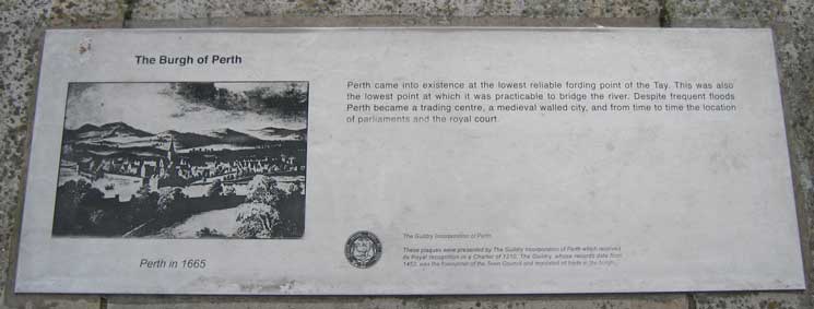
The Burgh of Perth(image caption: Perth in 1665) Perth came into existence at the lowest reliable fording point of the Tay. This was also the lowest point at which it was practicable to bridge the river. Despite frequent floods Perth became a trading centre, a medieval walled city, and from time to time the location of parliaments and the royal court. (seal) The Guildry Incorporation of Perth These plaques were presented by The Guildry Incorporation of Perth which received its Royal recognition in a Charter of 1210. The Guildry, whose records date from 1452, was the forerunner of the Town Council and regulated all trade in the burgh. |
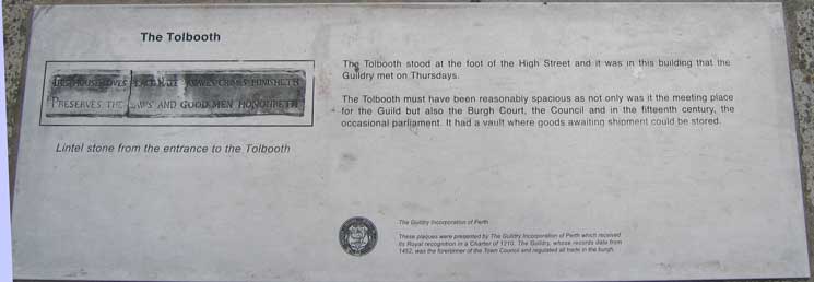
The Tolbooth(image reads: This house loves peace hate knaves crimes punishth (image caption: Lintel stone from the entrance to the Tolbooth) The Tolbooth stood at the foot of the High Street and it was in this building that the Guildry met on Thursdays. The Tolbooth must have been reasonably spacious as not only was it the meeting place for the Guild but also the Burgh Court, the Council and in the fifteenth century, the occasional parliament. It had a vault where goods awaiting shipment could be stored. (seal) The Guildry Incorporation of Perth These plaques were presented by The Guildry Incorporation of Perth which received its Royal recognition in a Charter of 1210. The Guildry, whose records date from 1452, was the forerunner of the Town Council and regulated all trade in the burgh. |
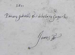
Enlargement from the main plate
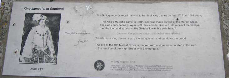
King James VI of Scotland(image caption: James VI) The Guildry records recall the visit to Perth of King James on the 15th April 1601 noting: "The King's Majestie came to Perth, and was made burges at the Mercat Croce. Thair was puncheons of wyne sett thair and drunken out. He receevit the banquet from the toun and subscrivit the Gildebuik with his awin hand." Jacobus Rex, parcere subjectis et debellare superbos. Translation - King James, spare the vanquished and put down the proud. The site of the Old Mercat Cross is marked with a stone incorporated in the kerb at the junction of the High Street with Skinnergate. (seal) The Guildry Incorporation of Perth These plaques were presented by The Guildry Incorporation of Perth which received its Royal recognition in a Charter of 1210. The Guildry, whose records date from 1452, was the forerunner of the Town Council and regulated all trade in the burgh. |
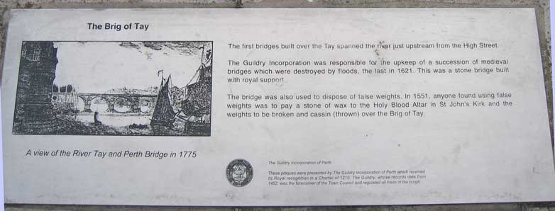
The Brig of Tay(image caption: A view of the River Tay and Perth Bridge in 1775) The first bridges built over the Tay spanned the river just upstream from the High Street. The Guildry Incorporation was responsible for the upkeep of a succession of medieval bridges which were destroyed by floods, the last in 1621. This was a stone bridge built with royal support The bridge was also used to dispose of false weights. In 1551, anyone found using false weights was to pay a stone of wax to the Holy Blood Altar in St John's Kirk and the weights to be broken and cassin (thrown) over the Brig of Tay. (seal) The Guildry Incorporation of Perth These plaques were presented by The Guildry Incorporation of Perth which received its Royal recognition in a Charter of 1210. The Guildry, whose records date from 1452, was the forerunner of the Town Council and regulated all trade in the burgh. |
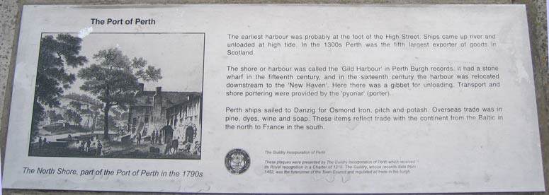
The Port of Perth(image caption: The North Shore, part of the Port of Perth in the 1790s) The earliest harbour was probably at the foot of the High Street. Ships came up river and unloaded at high tide. In the 1300s Perth was the fifth largest exporter of goods in Scotland. The shore or harbour was called the 'Gild Harbour' in Perth Burgh records. It had a stone wharf in the fifteenth century, and in the sixteenth century the harbour was relocated downstream to the 'New Haven'. Here there was a gibbet for unloading. Transport and shore portering were provided by the 'pyonar' (porter). Perth ships sailed to Danzig for Osmond Iron, pitch and potash. Overseas trade was in pine, dyes, wine and soap. These items reflect trade with the continent from the Baltic in the north to France in the south. (seal) The Guildry Incorporation of Perth These plaques were presented by The Guildry Incorporation of Perth which received its Royal recognition in a Charter of 1210. The Guildry, whose records date from 1452, was the forerunner of the Town Council and regulated all trade in the burgh. |
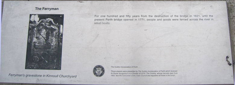
The Ferryman(image caption: Ferryman's gravestone in Kinnoull Churchyard) For one hundred and fifty years from the destruction of the bridge in 1621, until the present Perth bridge opened in 1771, people and goods were ferried across the river in small boats. (seal) The Guildry Incorporation of Perth These plaques were presented by The Guildry Incorporation of Perth which received its Royal recognition in a Charter of 1210. The Guildry, whose records date from 1452, was the forerunner of the Town Council and regulated all trade in the burgh. |
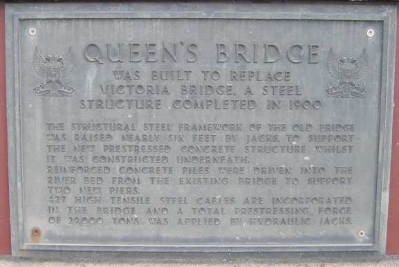
Queen's Bridge [plate]was built to replace Victoria Bridge, a steel structure completed in 1900 The structural steel framework of the old bridge was raised nearly six feet by jacks to support the new prestressed concrete structure whilst it was constructed underneath. Reinforced concrete piles were driven into the river bed from the existing bridge to support two new piers. 427 high tensile steel cables are incorporated in the bridge and a total prestressing forge of 29,000 tons was applied by hydraulic jacks. |
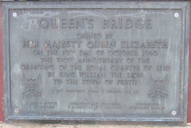
Queen's Bridge
|
| Burgh Surveyor | Engineers and Designers | Contractor |
| John Penman | F. A. MacDonald & Partners | Whatlings Limited |
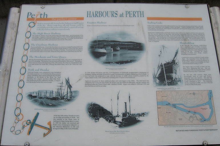
And this bit titled "Harbours at Perth":
|
Perth is strategically located at the highest navigable point of the Tay. Heavy cargo from all over Europe could be carried almost to the centre of Scotland, a great advantage in the days before railways or paved roads. The High Street HarbourThe medieval harbour was at the eastern end of the High Street, just downstream of the early bridge. It appears on the earliest plan of Perth (1715), with the Tolbooth directly west of it where customs were collected, and the burgh council met. It is called the North Shore in a charter of the early 1600s, and remained in use into the 19th century. The Greyfriars HarbourThe second harbour was close to the Greyfriars on a site now occupied by the Quayside Court sheltered housing. It is mentioned in the Perth Guildry Book in 1539 as The New Haven by the Greyfriars, and is shown on the 1715 plan as The Kay. It took the form of a basin at the mouth of the canal or town lade, which ran along what is now Canal Street into the Tay. The Merchants and Lime QuaysMoving downstream provided deeper water for larger ships, and a less congested area on shore for unloading. This harbour was reconstructed during the 18th century. The harbour basin went out of use at the beinning of the 19th century, but wharves extended down the river bank beside the South Inch, forming Merchants Quay, and in the 1830s the Lime Quay. Perth and DundeePerth and Dundee were commercial rivals throughout the medieval period. In 1316 Robert the Bruce issued a charter forbidding ships which sailed past the Drumlay Sandbanks at the mouth of the River Tay from unloading their cargoes anywhere other than Perth. Only goods specifically ordered by Dundee, or cargoes arriving during Dundee fairs were exempt. In the late 16th century Dundee levied a tax on ships proceeding to Perth, and this resulted in the whole issue of trading privileges being taken to court. In 1602 the matter was resolved and Perth's area of monopoly reduced to a line between Balmerino in Fife and Invergowrie Bay to the west of Dundee. Friarton HarbourPerth's current harbour is at Friarton, about a mile down river, in much deeper water. In 1834, Robert Stevenson and Son, Civil Engineers of Edinburgh recommended a programme of dredging, fording and water diversion to create a permanently navigable channel up river to Perth. A new wet dock was proposed to cope with the increase in traffic which would be created by the improvement works, with a tidal basin extendeding from Friarton to the South Inch. Approval was given for these ambitious plans and work began in the 1840s. The tidal basin was completed, but it was not long before the project ran into financial difficulties, and the scheme was abandoned when the Town Council debt reached £70,000. Quays were added in 1898 and 1939, and these facilities are still in use today. Trading LinksPerth's main overseas trade in the medieval period was with northern Europe and the Baltic, although contact was maintained with England, France and Spain. Exports included hides, leather goods, wool, salmon, coal and salt, while imports included flax and linseed for the growing textile industry, wood and resin, iron and wine. Perth tried to establish links with North America, but could never compete with the west coast ports. The Tay was too shallow for big ships, and growing competition from the railways reduced the importance of coastal and river craft. It was not until the 1950s that ships began to return to Perth in any numbers. The introduction of the diesel engine allowed the construction of ships with a shallow draught that could navigate the river channels to the port at Friarton. The present harbour, like its predecessors, carries on a busy trade with Scandinavia, the Baltic, the Low Countries and the east coast of England. ShipbuildingIn the 18th and 19th centures, shipbuilding was a significant part of Perth's economy. Timber was floated down river from northern Perthshire to the many small shipyards on the banks of the Tay. Amongst the vessels launched at Perth were sloops, smacks, brigantines and schooners. Construction was not confined to small sailing ships. The steamship Union, the first twin-hulled ship in Britain, was built by Brown of Perth in 1821, and an iron steamship, the Eagle was built by Perth Foundry in 1836. The largest ship ever built in Perth was the Mary Gray, displacing 446 tons. She was launched in 1840, but wrecked off the Lofoten Islands of Norway only 17 years later. By the late 19th century, ships were increasingly built of iron, and Perth's shipyards went into decline. the last big sailing ship built in Perth was the Ballinbreich Castle, launched in 1879. The steamship Bertha, launched in 1896, was one of the last products of the Perth yards. INITIATED AND FUNDED BY PERTH PARTNERSHIP |
After leaving Perth, we went to the Caithness Glass Factory for some fancy glass rocks.